Everglades Science and Restoration Center
Leading the science behind one of the largest environmental restoration projects on the planet
Leading the science behind one of the largest environmental restoration projects on the planet

40+
Years working on research in the Florida Everglades
105+
Faculty, staff and students working on Everglades research, education and restoration
66
ForEverglades & Cristina Menendez Scholars since 2008
The FIU Everglades Science and Restoration Center is committed to saving and protecting the environmentally and economically important Florida Everglades through data-driven science, long-term monitoring and community engagement. Located on the edge of Everglades National Park and with more than 100 researchers focused on solutions-centered projects, FIU is helping create an inspiring and sustainable future for this iconic yet imperiled ecosystem.

RESEARCH
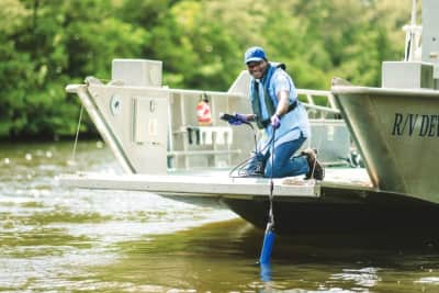
FIU researchers have spent more than four decades guiding restoration and protection of water resources and wildlife in and around the Everglades. As part of this work, FIU leads the National Science Foundation's Florida Coastal Everglades Long-Term Ecological Research program.

EDUCATE
FIU provides hands-on instruction for students interested in careers supporting the Everglades. This includes degrees in sustainability and the environment, biology, chemistry, global sustainable tourism, engineering, public policy and more.
ENGAGE
Our work includes collaborations with local, regional, state, tribal and national agencies, the Everglades Foundation and other community organizations. Our Everglades Outreach Team provides free community education programs.
Our job is to advance Everglades restoration. We can only do this with the science behind us. FIU has been instrumental in helping us understand the vulnerabilities of the Everglades and in moving forward with restoration and preservation.Stephen Davis, Chief Scientist for the Everglades Foundation

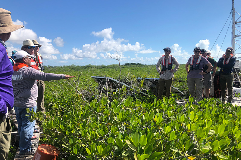
Environmental Monitoring
From sawgrass marshes to the seagrass meadows of Florida Bay, our scientists monitor real-time and long-term environmental conditions to reveal the causes and consequences of changes in the Everglades.

Extreme Events
Our scientists have been comparing how different hurricanes impact the Everglades for more than 30 years. They are also studying the impacts of fires, cold snaps, droughts and more.

One of only 27 long-term, integrative science programs funded by NSF, the FCE LTER is based at FIU and includes more than 140 scientists across 32 institutions who study how human activities interact with biological processes to transform the Everglades. Scientific findings inform and guide the science, assessment, advocacy and public awareness of Everglades restoration.
FIU led the research that established a water-quality standard to protect Everglades National Park from excess phosphorus. Decades of fertilizer use in nearby areas had polluted the River of Grass, leading to devastating ecosystem changes. By limiting phosphorous, our scientists helped chart a course for restoration. The standard was incorporated into the federal Comprehensive Everglades Restoration Plan and is still in place today.

Director of Institute of Environment
Research areas include aquatic ecology and predator-prey dynamics.

Endowed George Barley Eminent Scholars Chair
Research areas include algal ecology, diatoms and environmental change indicators.
Research facilities in the Institute of Environment provide monitoring, sampling, analysis, field operations support and other services. Our research groups feature experts studying specific phenomena and topics related to Everglades health, restoration, ecosystem services, economic impact and more.
Experts in FIU's Institute of Environment work with partners across the world to increase impact of research and community projects. This includes Everglades National Park, the Everglades Foundation, the Miccosukee Tribe of Indians, the South Florida Water Management District and many more focused on the Everglades.
The Everglades is home for threatened and endangered species, some of the oldest cypress trees on the planet and the largest continuous seagrass meadow on Earth. Providing drinking water for 9 million Floridians, the Everglades also serves as a buffer for coastal storms, mitigates climate change by absorbing CO2, and supports Florida fisheries, recreation and tourism.

Miccosukee, FIU team up to examine phosphorus in Big Cypress
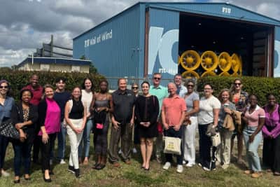
FIU hosts national leaders in Miami to showcase research and innovation

From labs to impact: FIU’s latest innovations in research and discovery

Tech to Protect

Genetic Engineering and the Endangered Species Act
Tracking harmful, forever chemicals in Florida’s waters


